Maps: Georgia, South Caucasus
Maps of
Georgia and
South Caucasus
Map of Georgia
1999 - Original title: Georgia.
Published: Washington, D.C. : Central Intelligence Agency, 1999
Map size: 19 x 17 cm.
Available through the Library of Congress Web site.
1920 - Original title: Carte de la Géorgie; échelle 1:3.000.000
Available also through the Library of Congress Web site.
On September 18, 1920 this map as an annex (out of five annexes) was submitted to the Council and Assembly of the League of Nations for the Admission of Georgia to the League of Nations, by the President of Georgian Delegation in London. (see more details about admission process of Georgia to the League of Nations here).
1918 - Original title: Carte économique de la Géorgie
This economic map of the Democratic Republic of Georgia in French was produced in 1918, the year in which Georgia declared its independence from the Russian Empire under a social democratic government.
In 1921 the Red Army invaded Georgia, and it became a Soviet socialist republic, once again under Russian domination. Georgia became an independent state in 1991, following the breakup of the Soviet Union.
Map size: 45 x 61 cm.
Available through the Library of Congress Web site.
Ethnological Map of the Caucasus
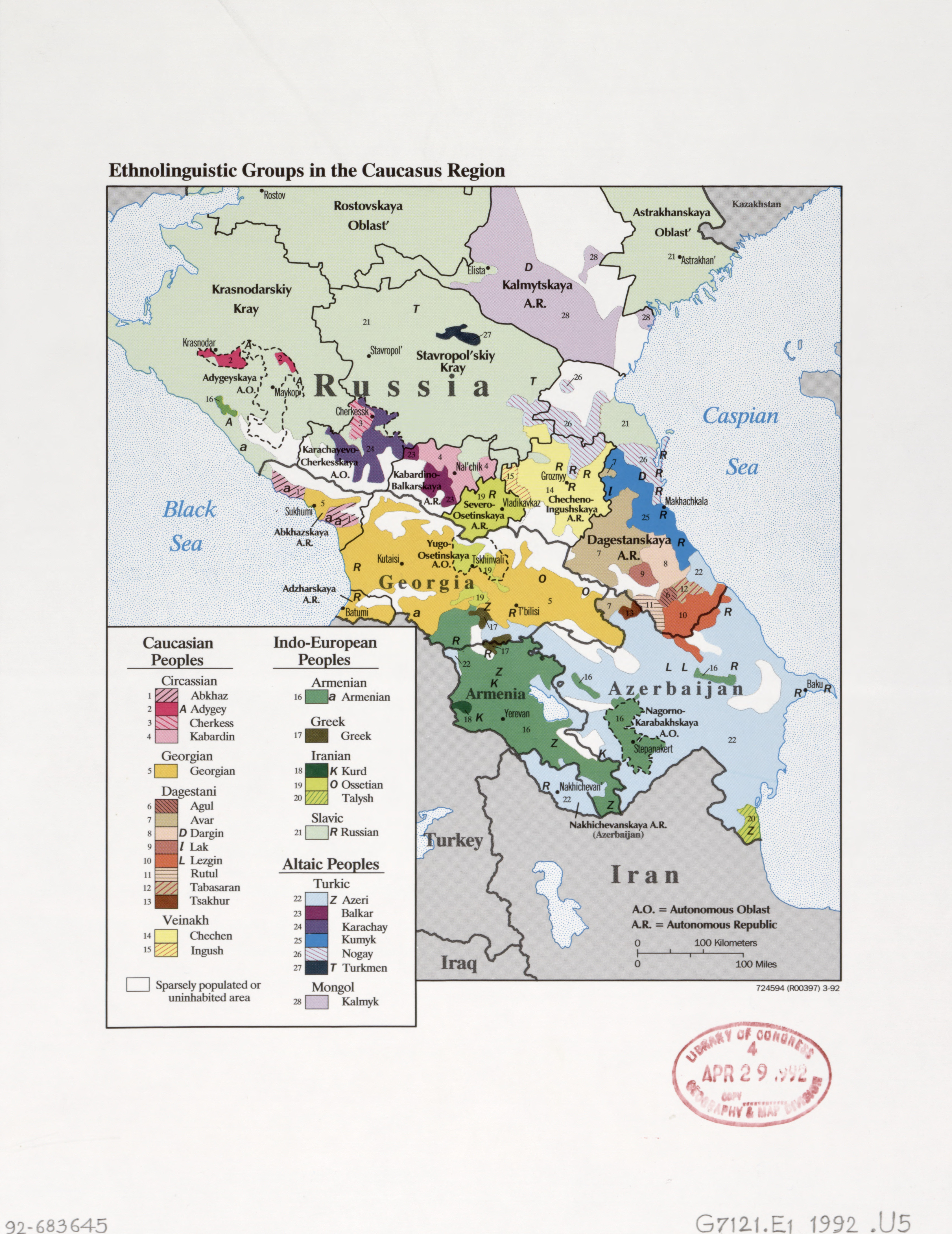
1992 - Original title: Ethnolinguistic groups in the Caucasus region.
Map size: 18 x 17 cm.
Available through the Library of Congress Web site.
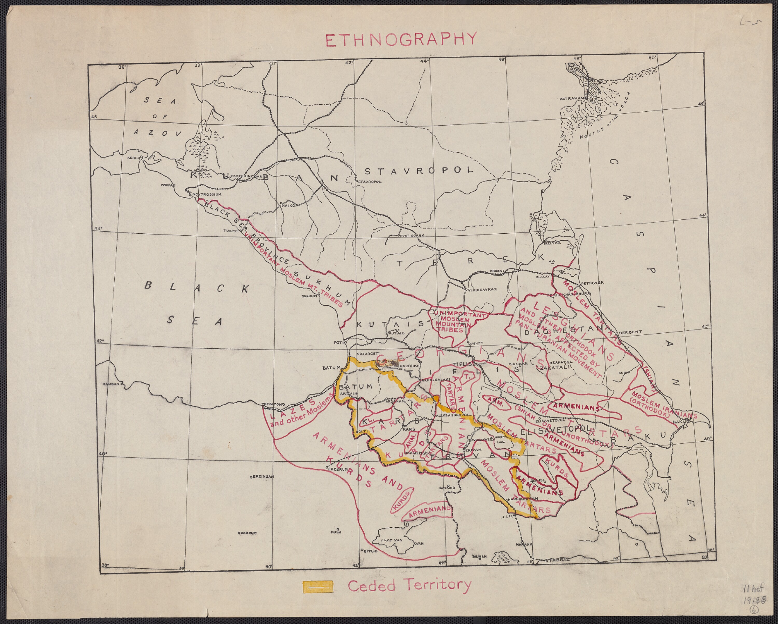
1910 - Original title: Ethnography.
Map size 51x42 cm.
From West to East: 1385.8 km
From North to South: 1263.3 km Square: 1750661.3 km2
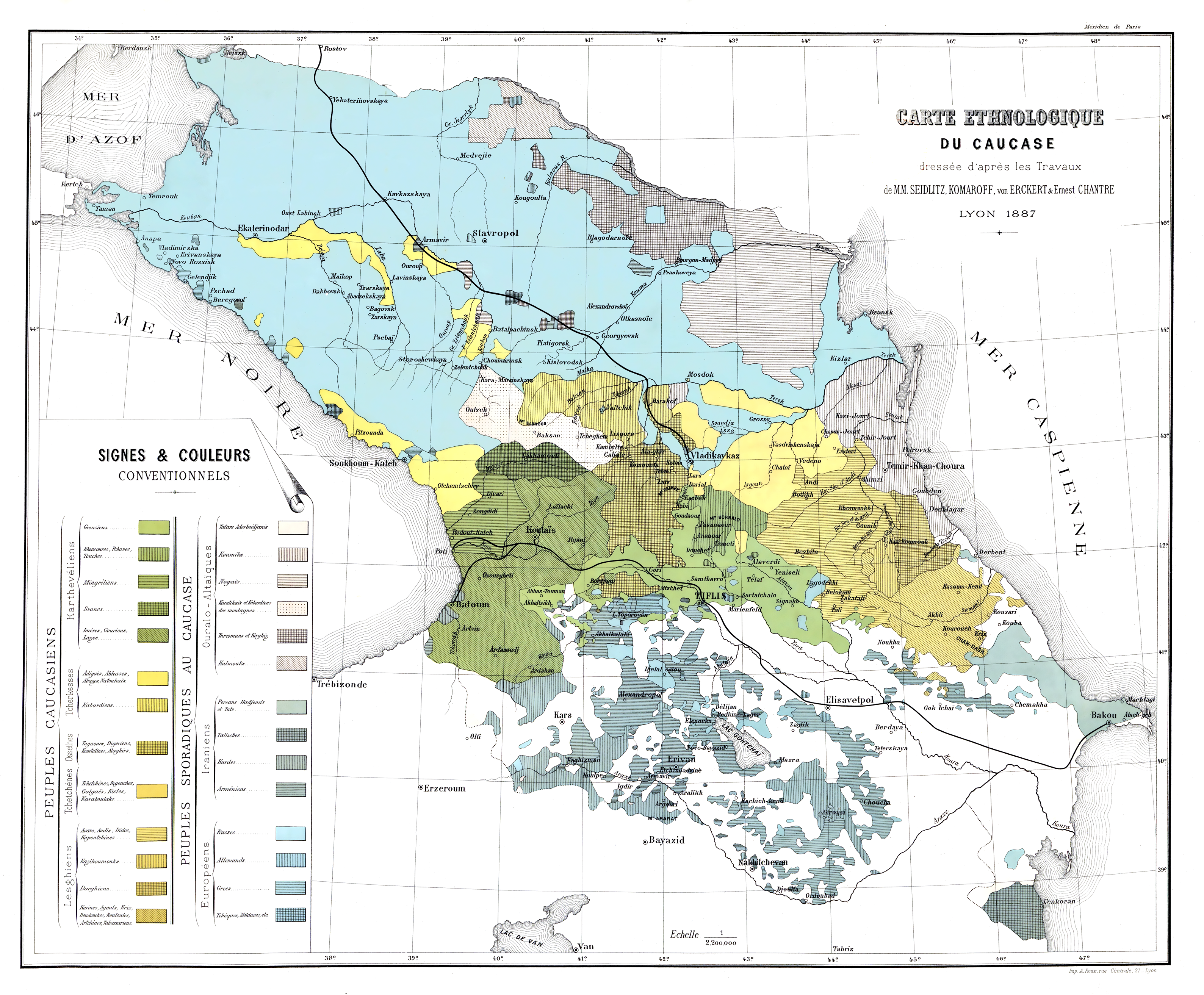
1887 - Original title: "Carte ethnologique du Caucase".
Authors: Seidlitz; Komaroff; von Erckert Chantre; et Ernest Chantre.
Publisher: A. Roux (Lyon).
Language: French.
Sheet format: 55x45 cm.
See also:
Directions:
Contact:
5 Machabeli Street, Tbilisi 0105, Georgia.
+995 (32) 2999987
![]()